New web application for estimating landscape biodiversity support in Estonia
20.04.2020
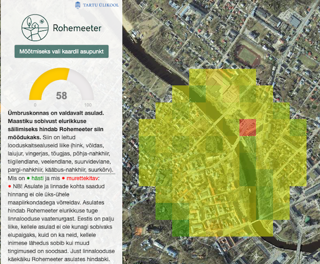
Meelis and Aveliina (Landscape biodiversity workgroup) have led the development of a new web-based application to estimate how well landscapes support biodiversity. The easy to use application Rohemeeter (currently in Estonian only) allows users to explore terrestrial areas in Estonia - by choosing a location, the application calculates the current situation of biodiversity support in a 500 m radius, lists protected species and gives suggestions for protecting or restoring biodiversity. The application uses ~70 map layers, including current and historical habitat and species distribution maps as well as maps describing environmental or landscape characteristics.